Our solutions
Overview
Delivering innovative solutions and high-quality marine geophysical data on time.
We process and interpret marine geophysical survey data, turning it into clear, reliable information used to design, build and operate offshore projects.
With over 200 automated data processing solutions, we accelerate data delivery without compromising quality, enabling faster decision-making and smoother project execution.
We believe offshore data can be processed faster, more reliably and more intelligently - and we continuously push the boundaries to make that possible.
Turnkey Solutions for your Offshore Projects: Unmatched Efficiency and Data Quality
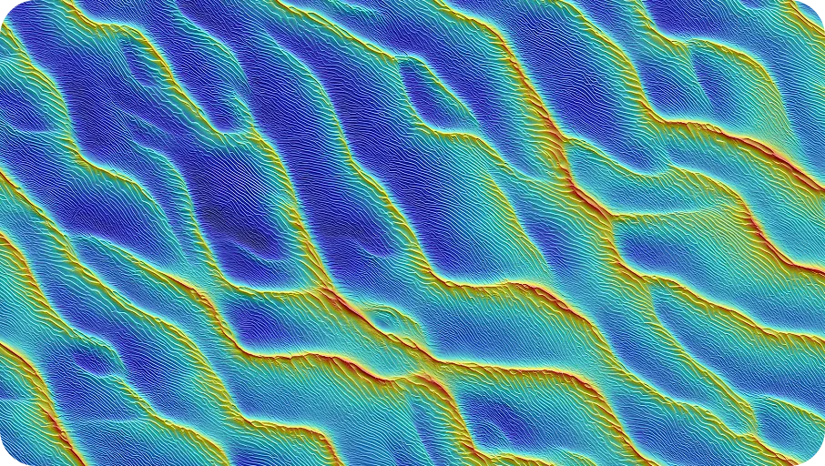
Geophysical Data Analysis & Processing
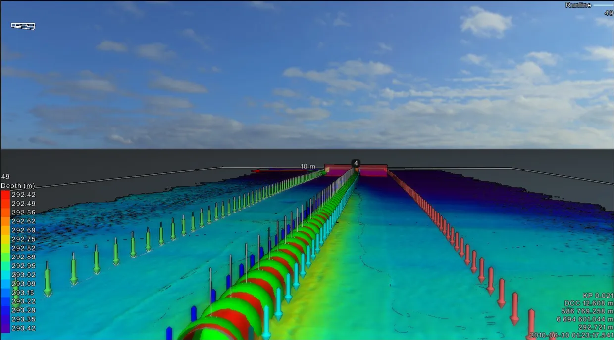
We process and interpret MBES, SSS, SBP and MAG data to deliver clear, reliable marine geophysical insights you can trust. All outputs are accurate, compliant with industry standards and ready for immediate use in offshore engineering projects.
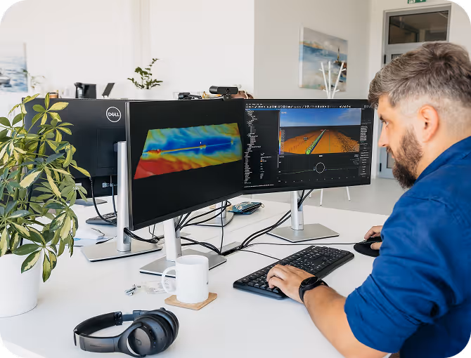
Automated Data Processing
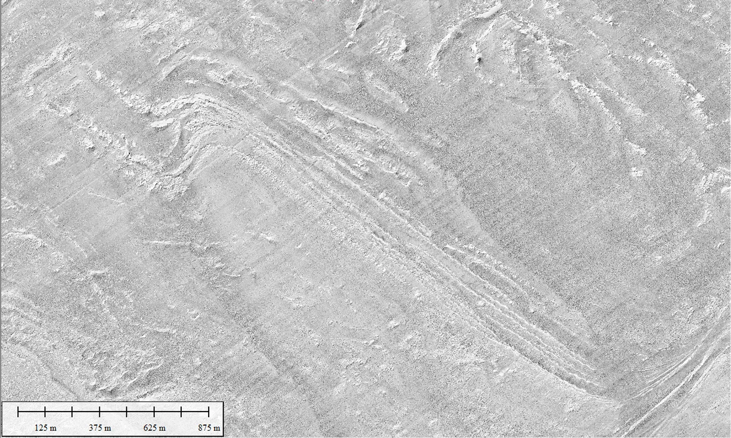
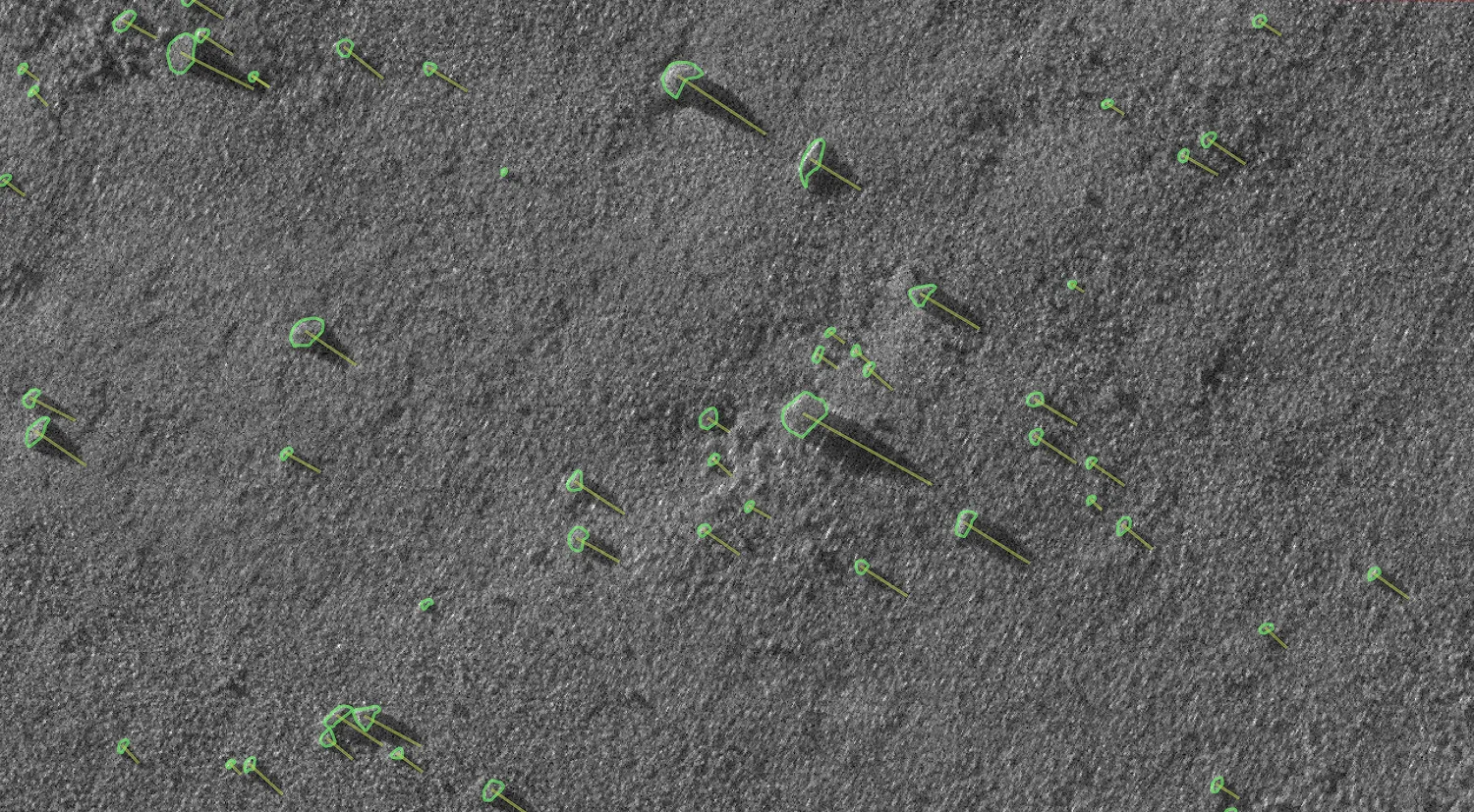
We identified slow and repetitive workflows in standard processing software and developed over 200 proprietary Python-based scripts to solve them. Today, we use these custom solutions to automate critical tasks - including world-leading automated boulder detection and target picking from MBES, SSS, SAS, and MAG data. This approach makes the entire process faster and more efficient while ensuring unmatched precision and reliability.
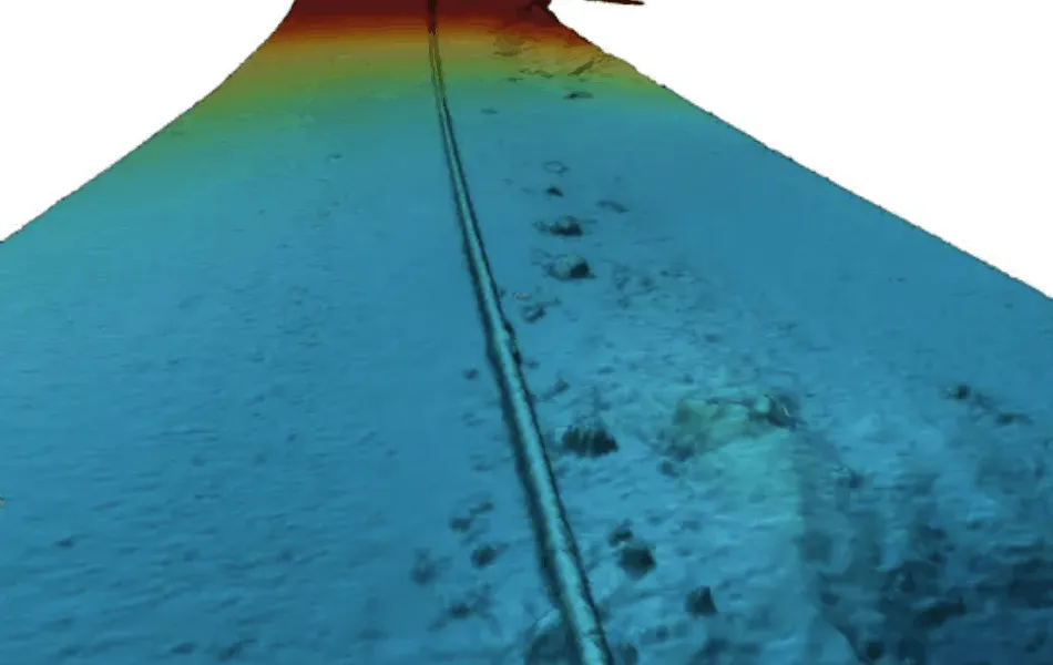
Offshore Construction Data Support
We support offshore infrastructure projects by providing reliable data for planning, installation and monitoring. Our work helps identify seabed features and potential risks, supporting safe and efficient operations such as cable laying, dredging and infrastructure inspection.
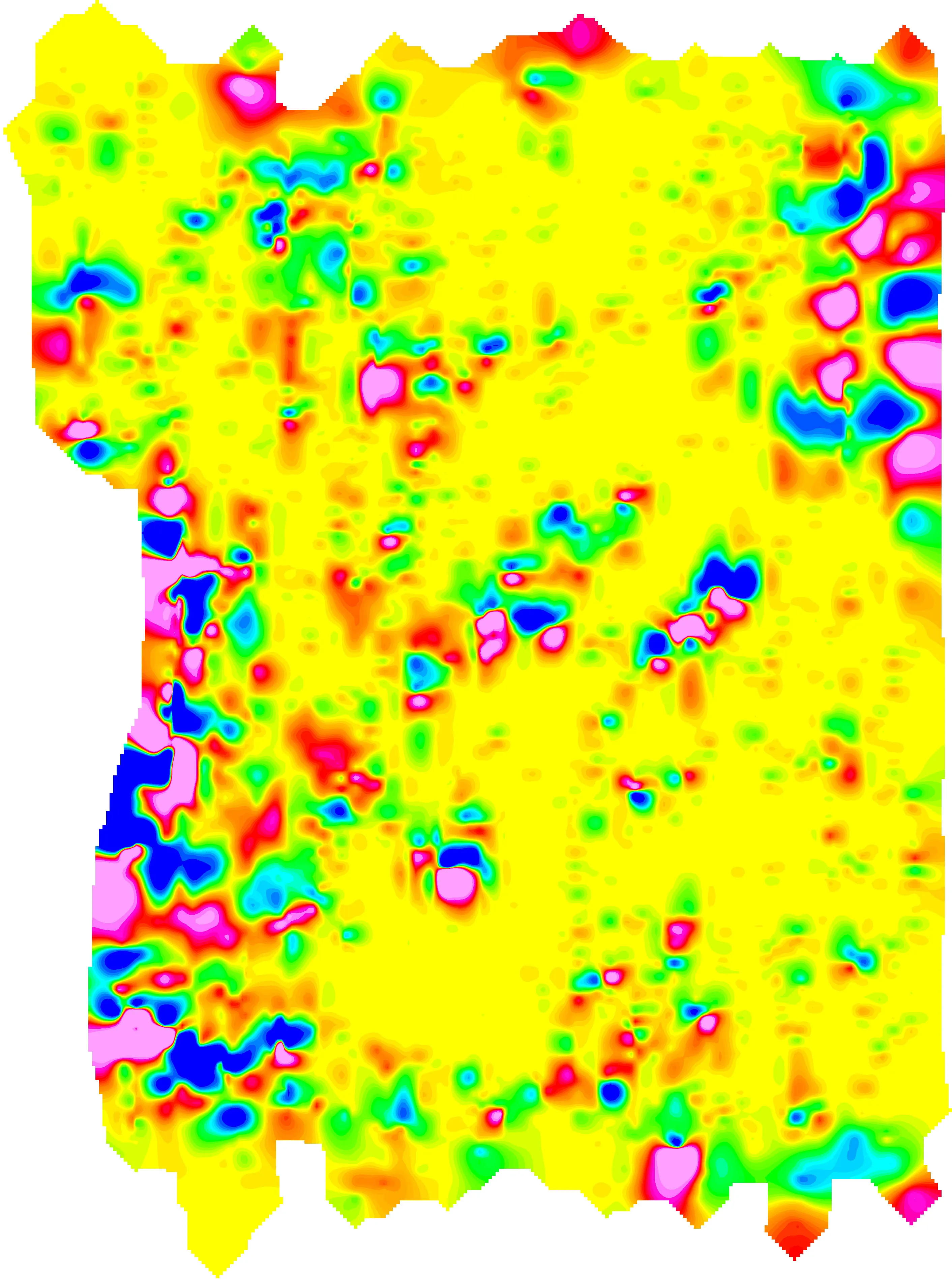
GIS & Charting
We transform complex geophysical datasets into clear, structured, and easy-to-use GIS deliverables that strictly adhere to IHO standards. Our expertise includes implementing standardized SSDM database models and automated workflows to produce high-quality charting outputs. All maps, mosaics, and gridded surfaces are delivered in industry-standard formats, providing actionable insights for informed decision-making.

Reporting & Consultancy
We combine and structure all project data into integrated, standardized reports using efficient templates and deep domain expertise. Each report brings together all relevant information into a clear and complete overview of the project, delivered to the highest industry standards and ready for immediate use.
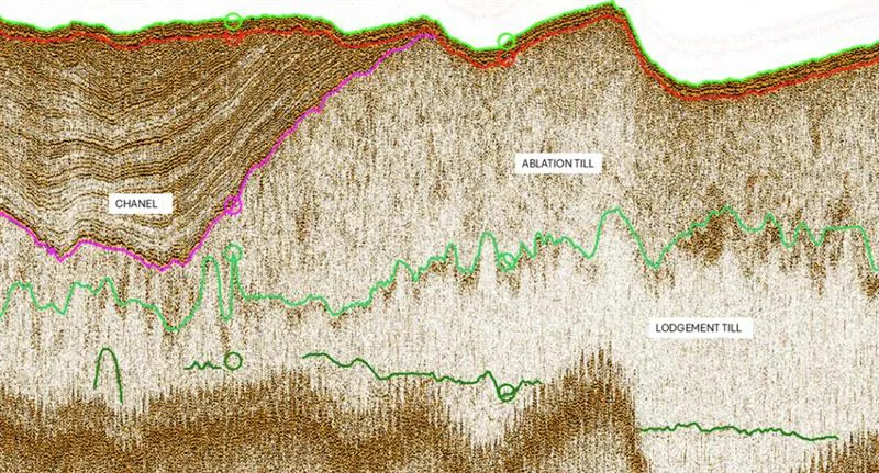
Seabed Risk & Lifecycle Intelligence
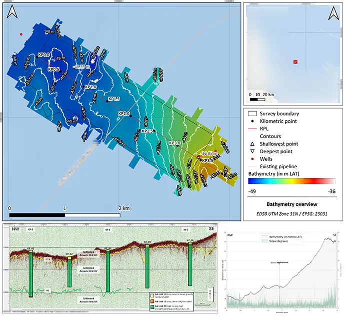
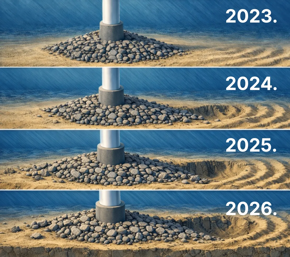
We identify and assess subsea risks by combining bathymetry, side-scan sonar, magnetometer and sub-bottom data. By analysing multi-epoch datasets and detecting changes over time, we highlight potential hazards such as seabed objects, buried features and unstable areas. Our approach ensures that maximum value is extracted from the data, providing clear and reliable insights for safer offshore construction and long-term asset stability.
Remote online survey
We provide real-time remote survey support with integrated monitoring, quality control, and deliverables production. By leveraging secure remote connections, our experts can supervise offshore operations from our processing centers, ensuring data integrity without the need for additional offshore personnel. This collaborative approach enables faster decision-making, reduces operational risks, and ensures high-quality results are delivered as the survey progresses.
Earth observation & Geospatial analytics
We bring Earth Observation into our processing portfolio, extending our reach from the seabed to space. Working on active ESA projects - we turn Copernicus Sentinel data and commercial imagery into decision-ready insights. By combining open EO foundation models, our proprietary automated processing frameworks and deep marine domain expertise, we deliver faster, more reliable and more intelligent geospatial intelligence across marine, coastal and land applications. Our in-house R&D program continues to push this capability toward new operational and conversational services.
Your Partner in Offshore Success
We collaborate closely with clients across offshore wind, oil & gas, and marine construction sectors, offering comprehensive support for projects of all sizes - from survey planning to data analysis and reporting.
By working with us, our partners receive not only top-tier services but also the opportunity to grow alongside us, benefiting through shared experiences, insights, and results. This collaborative approach fosters stronger, more informed decision-making and drives long-term success.

Beyond the Data: Our Collaborative Approach
Comprehensive Support
Providing specialized services across offshore wind, oil & gas, and marine construction sectors.

End-to-End Solutions
Managing everything from survey planning to detailed data analysis and final reporting.
Collaborative Growth
Growing alongside our partners through shared insights and informed decision-making.
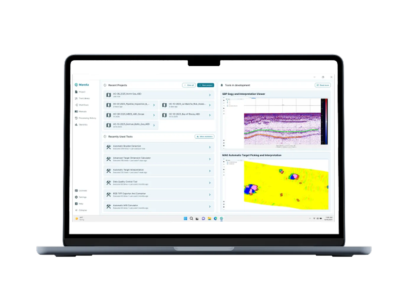
Automation Platform
Your automation engine for the entire processing pipeline.
